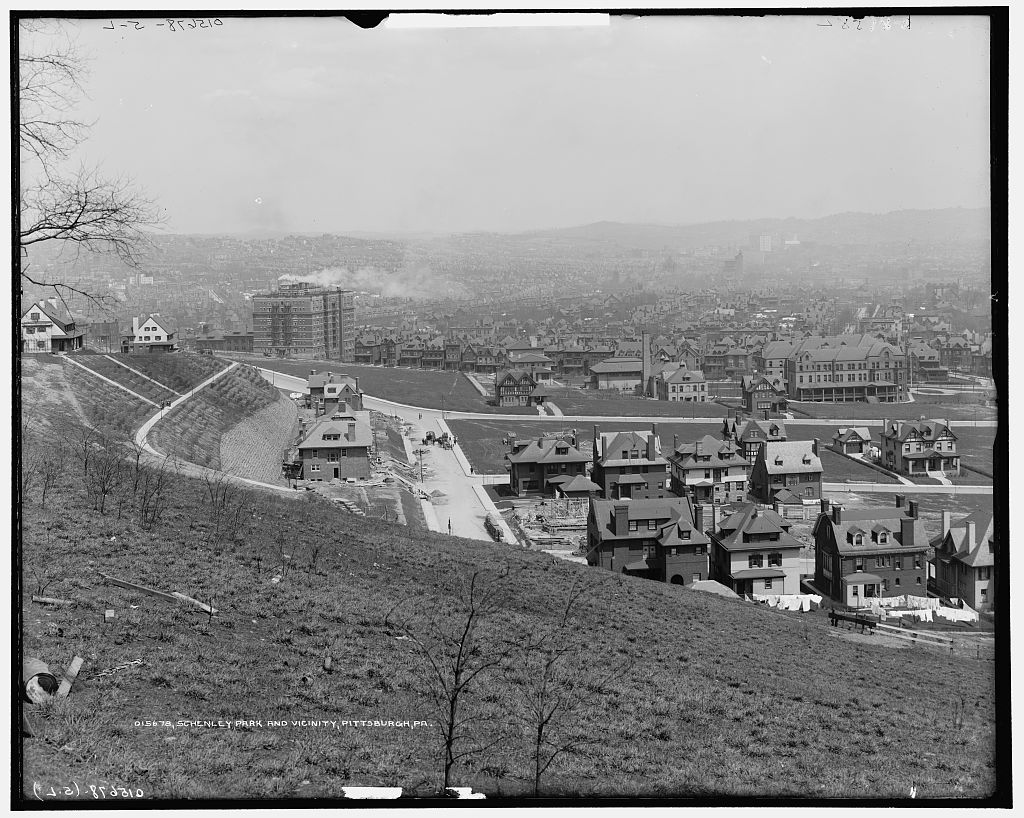
View looking east from Schenley Farms across Shadyside c.1911. Image courtesy of Library of Congress, Prints & Photographs Online Catalog.
The above image has detailed views of early development in the Schenley Farms neighborhood of Oakland and is the leftmost image of a pentaptych (five photograph) view of Pittsburgh’s East End around 1911. I saw it a couple of days ago just after lamenting that I only know of one old image of Wallingford Street in Shadyside (please see my June 16, 2017 post “Wallingford Street and the Hunt for Early Shadyside Images”). It occurred to me that Wallingford Street is somewhere in this photograph.
Please don’t try to zoom in on the above image to see details! The Library of Congress provides online access to a huge very high resolution file (158.4 MB). Too large to post as an image on a webpage. I’ll do some zooming for you below and then I’ll tell you the exact place to get this and the other four images should you like to explore them yourself.
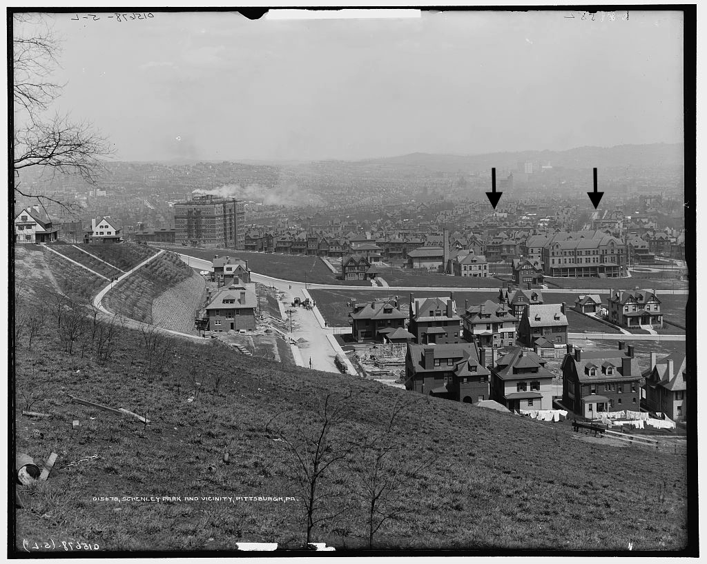
Annotated view looking east from Schenley Farms across Shadyside c.1911. The right arrow points to Bayard Street. The left arrow points to Wallingford Street. Image courtesy of Library of Congress, Prints & Photographs Online Catalog.
First let’s get oriented by pointing out a couple of streets and buildings. Above is an identical image but with two black arrows. The right arrow points to Bayard Street. If you follow Bayard to the large structure standing in Schenley Farms, you’ll find a building just behind this structure and to the right of Bayard. This is the D’Arlington Apartments building (still standing) built during 1909 and 1910 (in a moment you’ll see a close-up). The left arrow points to Wallingford Street. Don’t worry. At this resolution you cannot see the street well but you will when we look at the close-up. Notice the dark shape, almost like the profile of a stuffed chair, to the right of the arrow’s stem. That is Shadyside Hospital. Harder to see are the small dark and then light rectangles at about 2-O-Clock from Shadyside Hospital. The dark rectangle to the left was East End Savings Building (demolished). The white rectangle was the Highland Building (still standing).

View looking east from Schenley Farms c.1911. Image courtesy of Library of Congress, Prints & Photographs Online Catalog.
The image above zooms into the Shadyside neighborhood around Bayard (right) and Wallingford (left) Streets, starting at Neville Street which is hidden behind the buildings parallel with the bottom edge. The D’Arlington Apartments building is at the bottom right corner. Shadyside Hospital, a homeopathic hospital at the time, is more visible as are the East End Savings (darker tower at left) and Highland (white tower at right) Buildings in East Liberty.

View of Wallingford Street from Neville Street to Morewood Avenue. Detail from image courtesy of Library of Congress, Prints & Photographs Online Catalog.
Finally, the above detail focuses on Wallingford Street. Depth is significantly collapsed but I’m able to pick out the individual houses. Can those of you living on Wallingford see your house? Those interested in more detail may download a higher resolution file containing the same image (1.1 MB).
Those wanting to explore further may find the full pentaptych on the Library of Congress webpage Schenley Park and Vicinity, Pittsburgh PA. Please let me know if you have any questions or if you have old photographs to share!