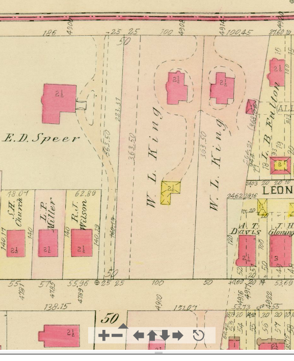
1911 Platt Map, Plate 1 showing a detail of Shadyside. Centre Avenue is along the top edge. Wallingford Street is parallel to the bottom edge. Devonshire Street meets Wallingford Street at bottom left of center. Map courtesy of Historic Pittsburgh, the Digital Research Library at the University of Pittsburgh.