Clipping of a 1892 Schenley Riding Academy advertisement. The Bulletin volume 18 clipping courtesy of Historic Pittsburgh, the Digital Research Library at the University of Pittsburgh.
Schenley Riding Academy occupied much of the land at the corner of Neville and Bayard Streets with stables, a riding ring, and other facilities during the nineteenth century. Many of Pittsburgh’s most prominent citizens were members and kept their horses at the academy. In addition, Schenley Riding Academy was a favorite place to rent horses for riding in nearby Schenley Park.

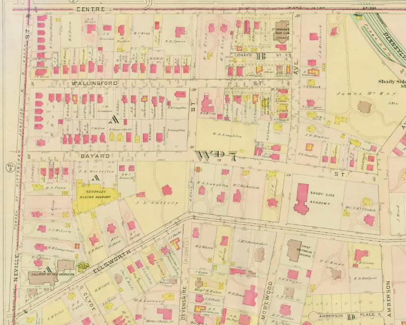
1911 Platt Map, Plate 1 showing a detail of Shadyside. Centre Avenue is along the top edge, Neville Street is along the left edge, and Amberson Avenue is along the right edge. Schenley Riding Academy is the bright yellow patch on the south side of Bayard Street about midway between Neville and Devonshire Streets. The stables take up less land than during the nineteenth century but still exist. Map courtesy of Historic Pittsburgh, the Digital Research Library at the University of Pittsburgh.
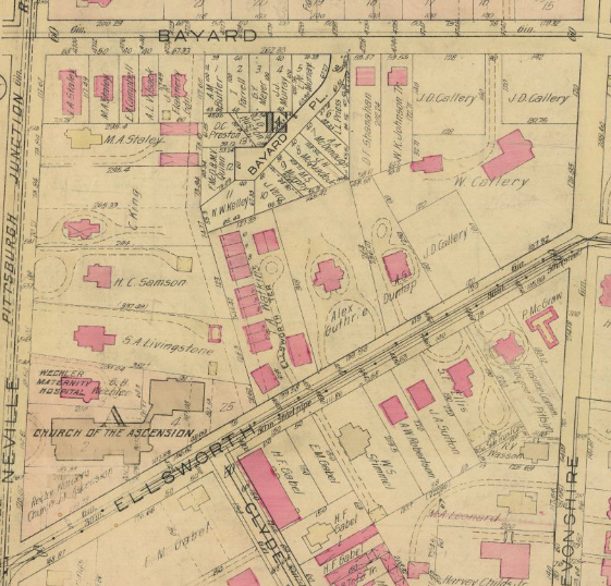
The growth of Pittsburgh into and around the suburb of Shadyside along with the rising value of land during the early twentieth century chipped away at the amount of land devoted to Schenley Riding Academy (see the 1911 map above). The horseless carriage ultimately led to its closure and development into Bayard Place (see the 1923 map below). The map doesn’t show houses built yet but the lots around Bayard Place are clearly spoken for!

1923 Platt Map, Plate 1a showing a detail of Shadyside and especially Bayard Place just off Bayard Street (a bit left of center). The homes on Bayard Place were built on top of what was Schenley Riding Academy. Map courtesy of Historic Pittsburgh, the Digital Research Library at the University of Pittsburgh.
Schenley Riding Academy was a hub of Shadyside activity and a core ingredient in the East End social scene for many decades before it closed.